Google Earth Engine——2017简化版本美国地理学家办公室提供大尺度国际边界(LSIB)数据集
Google Earth Engine——2017简化版本美国地理学家办公室提供大尺度国际边界(LSIB)数据集

LSIB 2017: Large Scale International Boundary Polygons, Simplified
The United States Office of the Geographer provides the Large Scale International Boundary (LSIB) dataset. The detailed version (2013) is derived from two other datasets: a LSIB line vector file and the World Vector Shorelines (WVS) from the National Geospatial-Intelligence Agency (NGA). The interior boundaries reflect U.S. government policies on boundaries, boundary disputes, and sovereignty. The exterior boundaries are derived from the WVS; however, the WVS coastline data is outdated and generally shifted from between several hundred meters to over a kilometer. Each feature is the polygonal area enclosed by interior boundaries and exterior coastlines where applicable, and many countries consist of multiple features, one per disjoint region.
Compared with the detailed LSIB, in this simplified dataset some disjointed regions of each country have been reduced to a single feature. Furthermore, it excludes medium and smaller islands. The resulting simplified boundary lines are rarely shifted by more than 100 meters from the detailed LSIB lines. Each of the 312 features is a part of the geometry of one of the 284 countries described in this dataset.
美国地理学家办公室提供大尺度国际边界(LSIB)数据集。详细版本(2013年)来自另外两个数据集:LSIB线矢量文件和国家地理空间情报局(NGA)的世界矢量海岸线(WVS)。内部边界反映了美国政府关于边界、边界争端和主权的政策。外部边界来自于WVS;然而,WVS的海岸线数据已经过时,一般在几百米到一公里以上的范围内变动。每个特征是由内部边界和外部海岸线(如适用)所围成的多边形区域,许多国家由多个特征组成,每个不相连的区域一个。
与详细的LSIB相比,在这个简化的数据集中,每个国家的一些互不相干的区域被减少为一个特征。此外,它还排除了中型和小型岛屿。由此产生的简化边界线与详细的LSIB线相比,很少有超过100米的偏移。312个特征中的每一个都是这个数据集中描述的284个国家中的一个国家的几何形状的一部分。
Dataset Availability
2017-03-30T00:00:00 - 2017-03-30T00:00:00
Dataset Provider
United States Department of State, Office of the Geographer
Collection Snippet
Copied
ee.FeatureCollection("USDOS/LSIB_SIMPLE/2017")
Name | Type | Description |
|---|---|---|
abbreviati | String | Country abbreviation |
country_co | String | [Two-letter FIPS country code](https://en.wikipedia.org/wiki/List_of_FIPS_country_codes) |
country_na | String | US-recognized country name |
wld_rgn | String | Continental region, e.g. South America |
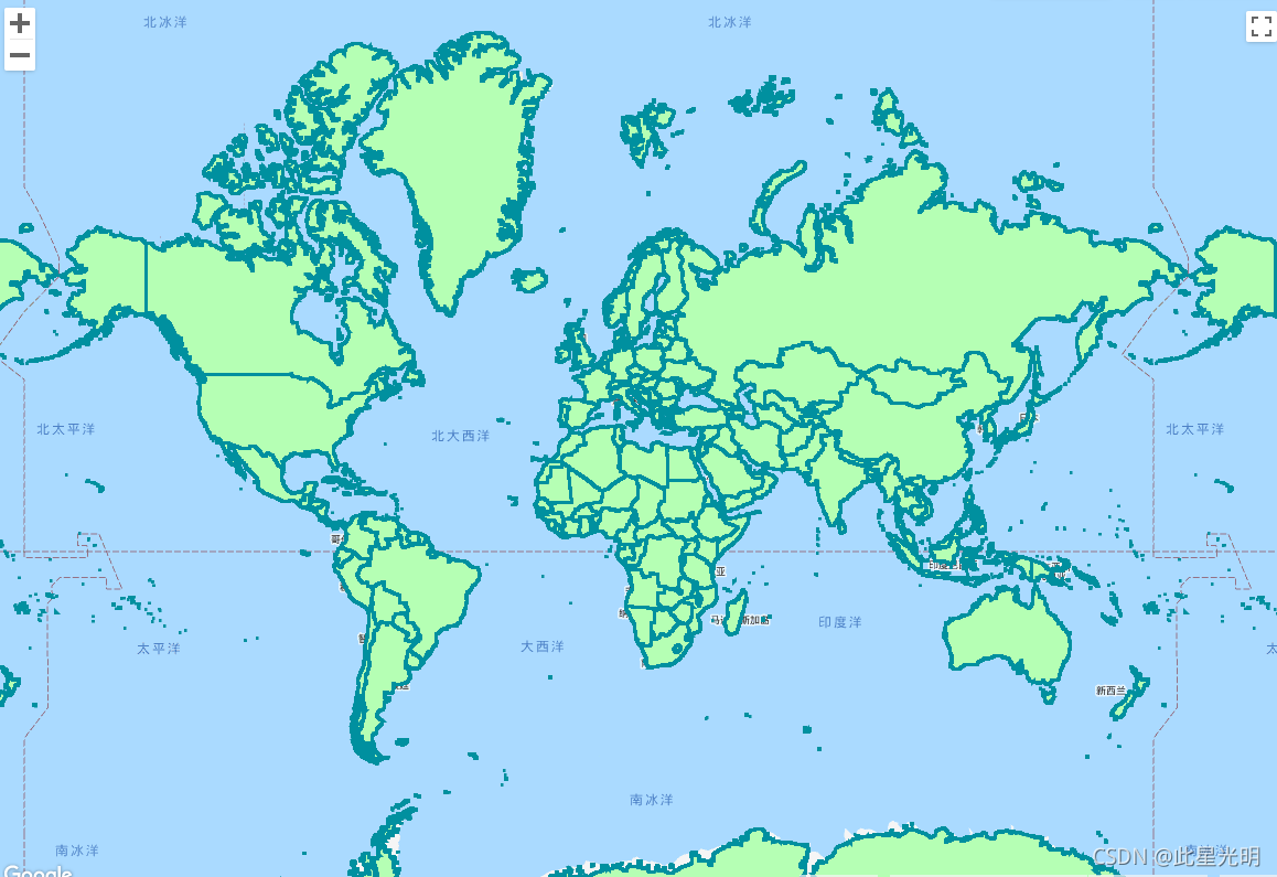
代码:
var dataset = ee.FeatureCollection('USDOS/LSIB/2017');
var styleParams = {
  fillColor: 'b5ffb4',
  color: '00909F',
  width: 3.0,
};
var countries = dataset.style(styleParams);
Map.setCenter(0, 0, 5);
Map.addLayer(countries, {}, 'USDOS/LSIB/2017');