Google Earth Engine ——FORMA是一个基于MODIS的湿润热带森林的毁林警报系统数据集
Google Earth Engine ——FORMA是一个基于MODIS的湿润热带森林的毁林警报系统数据集

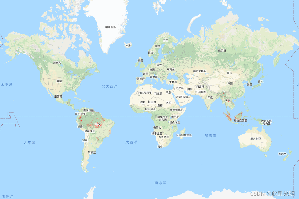
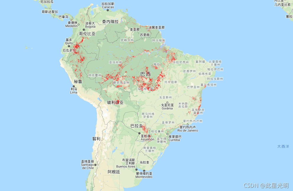
FORMA is a MODIS-based deforestation alerting system for the humid tropical forests. FORMA is designed for quick identification of new areas of tree cover loss. The system analyzes data gathered daily by the MODIS sensor, which operates on NASA's Terra and Aqua satellites. The FORMA alerts system then detects pronounced changes in vegetation cover over time, as measured by the Normalized Difference Vegetation Index (NDVI), a measure of vegetation greenness. These pronounced changes in vegetation cover are likely to indicate forest being cleared, burned, or defoliated. An alert is added to the dataset by setting the pixel value to the date at which a change was detected. FORMA alerts only appear in areas where the probability of tree cover loss is greater than or equal to 50%. FORMA data has 500-meter spatial resolution and twice-monthly update interval. FORMA alerts start in January 2006.
FORMA是一个基于MODIS的湿润热带森林的毁林警报系统。FORMA是为快速识别新的树木覆盖损失区域而设计的。该系统分析由MODIS传感器每天收集的数据,该传感器在NASA的Terra和Aqua卫星上运行。然后,FORMA警报系统检测植被随时间变化的明显变化,正如归一化差异植被指数(NDVI)所衡量的那样,这是衡量植被绿度的一个指标。这些植被的明显变化可能表明森林正在被清除、烧毁或落叶。通过将像素值设置为检测到变化的日期,警报被添加到数据集中。FORMA警报只出现在树木覆盖损失的概率大于或等于50%的地区。FORMA数据具有500米的空间分辨率和每月两次的更新间隔。FORMA警报于2006年1月开始。
Dataset Availability
2006-01-01T00:00:00 - 2015-06-10T00:00:00
Dataset Provider
Global Forest Watch, World Resources Institute
Collection Snippet
ee.Image("FORMA/FORMA_500m")
Resolution
500 meters
Bands Table
Name | Description | Min* | Max* | Units |
|---|---|---|---|---|
constant | [Seconds since Jan 1, 1970](https://en.wikipedia.org/wiki/Unix_time) | 1134979200 | 1433919600 | seconds |
* = Values are estimated
var dataset = ee.Image('FORMA/FORMA_500m');

var visualization = {
  bands: ['constant'],
  min: 1134979200.0,
  max: 1433919600.0,
  palette: ['ff0000']
};

Map.setCenter(-51.482, -0.835, 6);

Map.addLayer(dataset, visualization, 'Alert Areas');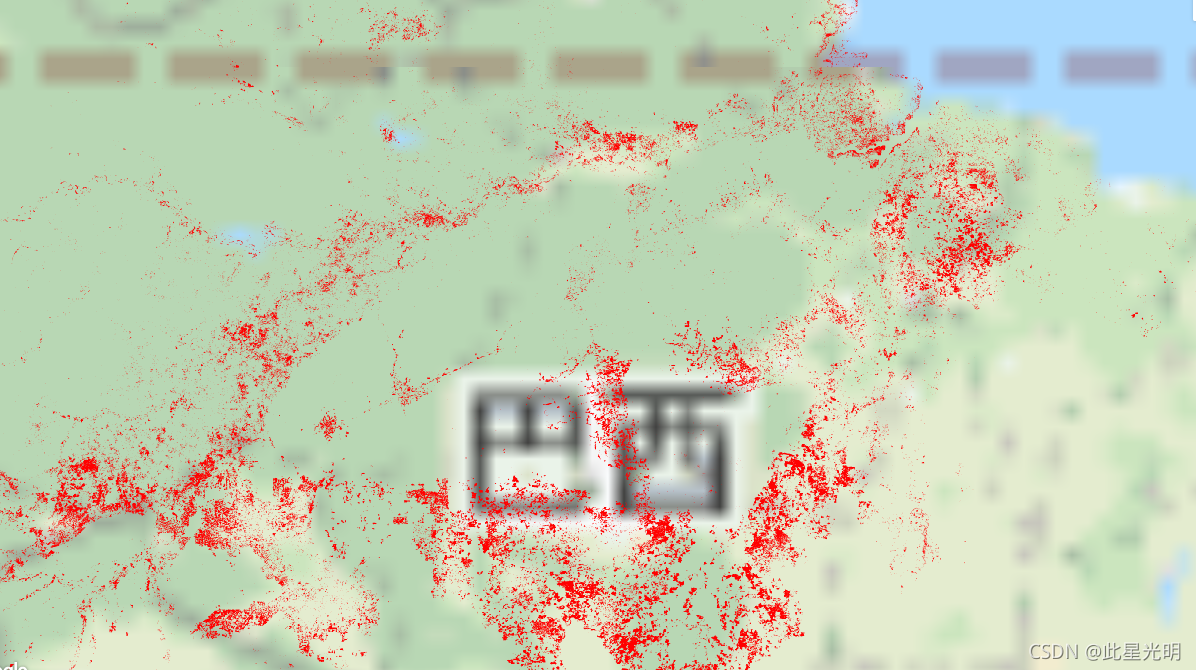
使用说明:
The FORMA datasets are available without restriction on use or distribution. WRI does request that the user give proper attribution and identify WRI and GFW, where applicable, as the source of the data.
引用:
Hammer, Dan, Robin Kraft, and David Wheeler. 2013. FORMA Alerts. World Resources Institute and Center for Global Development. www.globalforestwatch.org.